 I R O N R I V E R
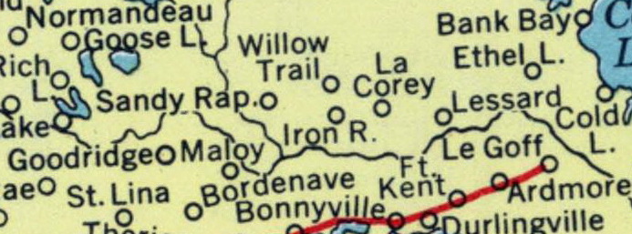
The settlement of Iron River, Alberta, emerged in the early 20th century as part of the broader wave of homesteading in northern Alberta, spurred by the Dominion Lands Act of 1872, which offered 160-acre quarter-sections of land for a $10 filing fee to eligible settlers. Homesteaders began arriving in the region around 1912, with initial settling and trapping activities noted that year, following the establishment of Lessard Church in 1911. The community took its name from the adjacent Iron River, a tributary of the Beaver River, reflecting the geographical features that defined early travel and resource use in the area. The Iron River post office opened on March 22, 1925, marking key early infrastructure. First permanent settlers established farms in the 1910s, clearing land for agriculture amid the challenges of isolation and harsh winters typical of the boreal transition zone. These pioneers, primarily from eastern Canada, the United States, and Europe, relied on horse-drawn wagons and river transport before rail connections improved access.
The Canadian Northern Railway significantly accelerated settlement by extending lines northward from Edmonton, reaching the St. Paul area by 1908 and facilitating further branch development into the Cold Lake district. The railway provided a vital link for transporting homestead supplies, lumber, and produce, which helped transform the scattered farms into a nascent community. By 1928, the area around the Iron River Post Office was described as well-settled, with much of the land under cultivation except for riverine tracts.
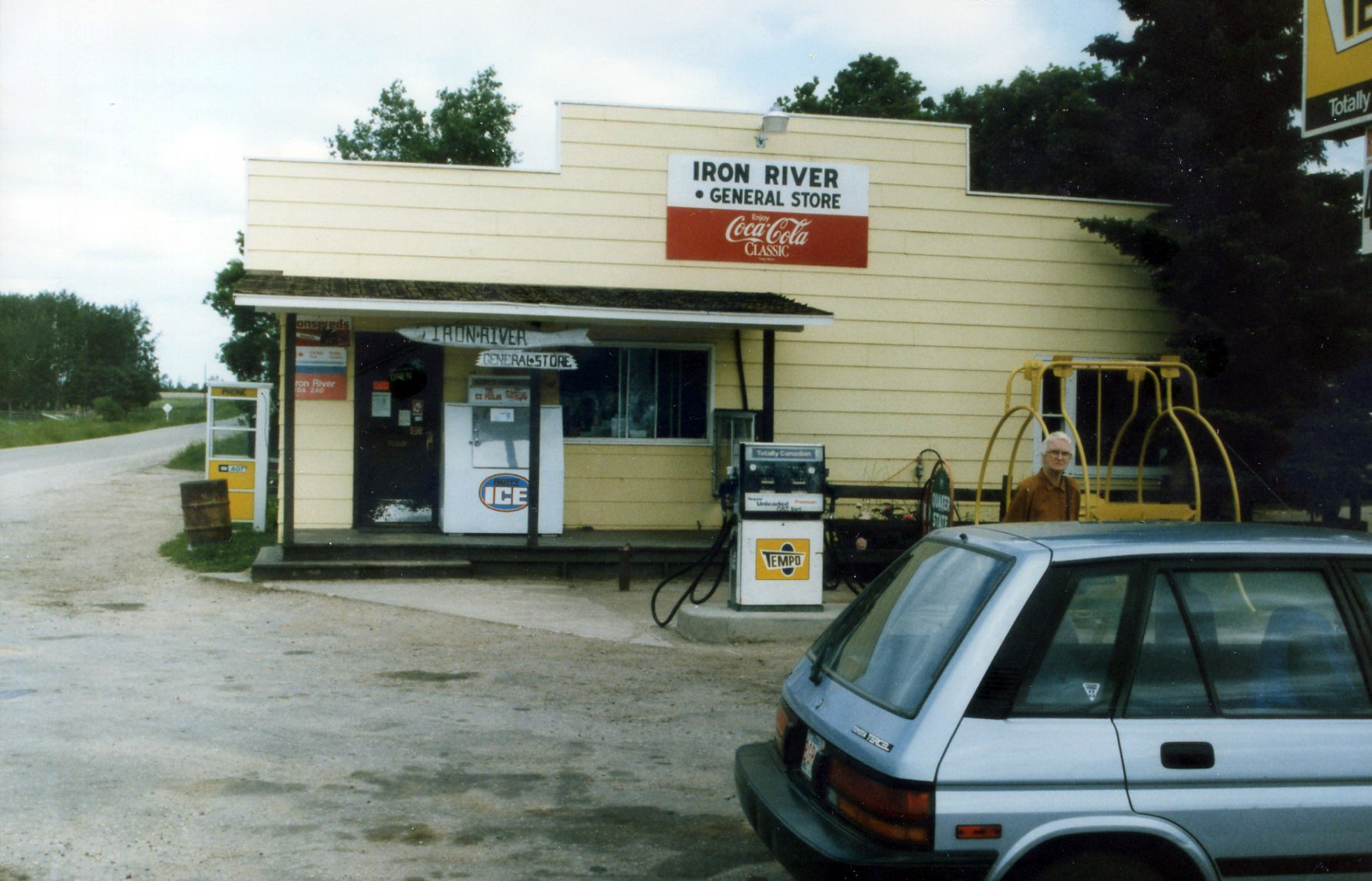
Iron River functions as a hamlet within the Municipal District of Bonnyville No. 87, reflecting its growing role as a service center for surrounding agricultural communities. Following World War II, infrastructure improvements significantly enhanced connectivity for Iron River. Post-war road development efforts improved access, with sections of Highway 55, which runs through the hamlet and links it to Bonnyville approximately 29 km to the southeast, paved in later decades.
The 1960s and 1970s brought economic diversification through oil exploration in the broader Bonnyville region, near Cold Lake oil sands, influencing local farming by introducing opportunities in related services while the area remained predominantly agricultural. Early settlement patterns, established via railway access in the 1910s, provided a foundation for this mid-century growth.
early 1990s